
Prattville Neighbor Record Sources
A block search should begin with records organized by place. The county parcel viewer supplies shape and adjacency. Appraisal cards add owner, mailing, situs, value, and legal-description clues one parcel at a time. County thematic maps can place the same block in voting, school, commission, and flood geographies. A recorded subdivision plat explains lot numbers and easements. Historical directories and released census schedules may identify past occupants. Public association pages offer contacts and notices, but no official citywide neighborhood-member directory was found.
| Source | What It Shows About a Block | Access |
|---|---|---|
| Parcel Viewer | Touching lots, parcel shapes and map context | Free map browse and click |
| Appraisal cards | Taxable owners, mailing and situs data, values | Free parcel-by-parcel search |
| County thematic maps | Precinct, school, commission and flood context | Free official maps |
| Subdivision plat | Lot and block pattern, easements and dedications | Probate Records Room |
| Directories and census | Historical occupants at dated addresses | ADAH, library or NARA |
| HOA or civic page | Public officers, contact channels and notices | Public pages only |
The distinction is vital. An appraisal owner may live elsewhere, hold the lot through a trust, or lease the property. A mailing address is where tax mail goes; a situs address is the assessed location. Matching the two can support an owner-occupancy inference, but it does not name family members or other occupants. Prattville neighbors in the everyday sense cannot be reduced to parcel-owner names.
Map Prattville Neighboring Parcels
The Autauga County Alabama Parcel Viewer is the cleanest start for the immediate block. Search or zoom to the subject location until individual parcel outlines are visible. Click the subject polygon and record its parcel identifier. Then click each touching or nearby polygon. Open the matching card in the Autauga Citizen Access property search and record the owner spelling, situs, mailing address, and legal description. The process is visual map browsing, not access to a private neighbor database.
- Standardize the starting address and confirm its point on the parcel map.
- Save the subject parcel ID, then click each touching lot in a consistent clockwise order.
- Match each ID or address to an appraisal card. Keep owner, occupant, and mailing facts in separate columns.
- Use the legal description and subdivision name to resolve gaps or odd lot shapes.
- For a whole named road rather than one block, switch to the Prattville street directory method.
A drawn radius is not required when adjacency is clear. Roads, drainage land, common areas, and large tracts can make the nearest home different from the parcel that shares the longest boundary. Preserve the map view and search date because parcel geometry and ownership can change.
Note: The official research confirmed browse, zoom, pan, layer, and identify behavior, but not a special configured buffer or automated neighbor-list tool.
Prattville Block District Context
Adjacent owners are only one layer of block research. Autauga County publishes interactive voting, commission, school, and flood maps. These maps help establish the public systems shared by nearby parcels. A block can sit in one precinct or school district while straddling another map line. Flood geography may explain open land or unusual lot patterns. None of those layers identifies who lives in a home, yet each can clarify why neighboring parcels receive different notices or appear in different public files.
Subdivision plats add another layer. A plat is the recorded plan that divides a tract into lots, blocks, roads, easements, and common areas. Probate keeps plats with land records, and its search is in person. Use the subdivision name, lot and block from an appraisal card to locate the right instrument. The plat can show that a green strip is common space, that two visible yards sit on one parcel, or that a rear access easement links lots that do not appear connected from the road.
Prattville Neighbors Across Counties
Prattville is Autauga County's seat, but the incorporated city extends east into Elmore County. That geography is the most important trap in a block lookup. A street address or 36066 mailing label does not prove that Autauga keeps the appraisal card, deed, plat, probate file, or court record. Confirm the parcel against county and city geography before declaring that a nearby property has no record. For an Elmore parcel, switch to the Elmore County appraisal, GIS, and Probate systems.
The same warning applies near city limits. “Prattville” is both a municipal name and a broader postal identity. A 36067 address may sit outside the incorporated line, while an east-side address may be inside Prattville but outside Autauga. County custody follows the land or filing jurisdiction, not the familiar city name printed on mail. This county-line check is why a careful Prattville neighbor search begins with geography.
Prattville Neighborhood Public Contacts
Community organizations add a voluntary layer that public land records cannot supply. Research located several public-facing Prattville association contacts, but no city-published directory of neighborhood members. Dawson's Mill HOA identifies officers and a contact form that asks the sender for a name, email, and address. Kingston Green describes a 76-home community with a pool and playground and publishes an HOA email. A management site publicly identifies Glennbrooke, Highland Ridge, McClain Landing, and The Ridge at Pratt Farms among its Prattville communities.
Dawson's Mill HOA
Public officers and a contact form are community-contact sources. The form is not a public resident roster.
Kingston Green
The association publishes community details and an HOA email, while household membership stays private unless released.
Managed Communities
Glennbrooke, Highland Ridge, McClain Landing, and The Ridge at Pratt Farms have public management references.
Chamber materials also identify civic groups such as Kiwanis, Lions, Friends of the Library, the Service League, and garden or newcomer groups. Those organizations can provide public event and officer information. Membership rolls remain private unless a group chooses to publish them. A public contact page should be used to ask about community matters, not to pressure an association into disclosing its members.
Prattville Voter Block Limits
Alabama's My Voting Information tool verifies one voter from personal inputs. It can return registration status, polling place, precinct, district, and election information. It cannot browse a block, street, or ZIP code. It never shows ballot choices. That design prevents the individual form from becoming a casual neighbor roster. Published precinct statistics and official district maps are the better tools for block-level civic context.
A statewide voter list is a separate paid statutory product under Ala. Code §17-4-38. Even where fields are releasable, protected-official procedures can shield information, and sensitive identifiers remain withheld. Alabama has no party registration, so primary participation must not be called party enrollment. Do not republish person-level voter data as a neighborhood list. The fact that a record is available for a lawful purpose does not erase stalking, harassment, identity-theft, or confidentiality rules.
Historical Prattville Neighbor Blocks
An older block needs dated sources. ADAH holds scattered Prattville city directories from 1962 through 2001, not a yearly run. A volume may contain a street or reverse section, but that feature must be confirmed onsite before claiming it lists houses in order. The federal census is public through 1950 and can name a household at the census date. Pairing a directory entry with a census schedule is stronger than treating either as a timeless statement about the block.
For the built setting, the Library of Congress offers a three-sheet 1911 Prattville Sanborn map and Prattville sheets within an 1894 Montgomery volume. Sanborn maps show footprints, construction materials, uses, street labels, and industrial landmarks rather than occupants. The 1894 catalog placement is easy to miss because Prattville appears under a Montgomery volume. Deeds, probate files, newspapers, and the ADAH Autauga subject files can connect names with the mapped places.
Historic downtown and Autauga Creek blocks often need these older map and record layers. Newer development toward Cobbs Ford Road and I-65 relies more on current appraisal, plats, permits, and GIS. That contrast keeps a Prattville neighbor search tied to the age and form of the block.
Prattville Neighbor Property Alerts
Autauga County's R.E.A.A.C.T. service watches indexed recording names, not activity inside a nearby home. A property owner can register name variants and receive an email when a later recorded document matches. The service warns of a possible filing but cannot stop, reverse, or remove a deed. A false or fraudulent instrument may still require court action. This tool belongs in a block-safety discussion only as a way to monitor one's own recorded name, not to track other Prattville neighbors.
The official R.E.A.A.C.T. announcement shows the signup instructions and the service's limits:
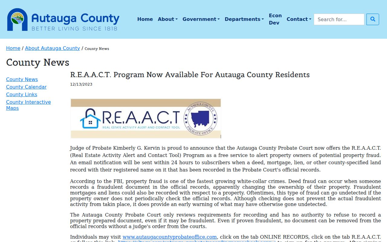
The image supports name-alert research, not proof of occupancy or parcel adjacency. Register each useful spelling variant and review any matched document with Probate before drawing a conclusion.
Note: Autauga Probate requires researchers to search recorded documents in person and will not provide deed book and page references by telephone.
Prattville Neighbor Source Comparison
Official sources and commercial neighbor tools serve different roles. County maps and rolls expose a stated public record with a named custodian, date, parcel, and correction path. Commercial products may join public, licensed, and inferred data, so an address or relative link can be old or wrongly merged. Neither source can turn an ownership record into proof of every occupant. Use commercial material only as a clue, and verify material facts at the office that owns the record.
| Source Type | Best Use | Main Limit |
|---|---|---|
| Parcel and appraisal records | Lot identity and taxable ownership | Owners are not always occupants |
| District and plat records | Civic boundaries and lot design | No household names |
| Historical records | Dated block and household research | Gaps and old addresses require care |
| Commercial compilations | Possible lead for later confirmation | Stale, inferred, or merged data |
Prattville Neighbor Privacy Limits
Renters and other household members do not appear merely because an appraisal card exists. Utility subscribers, driver addresses protected by the federal DPPA, library borrower histories, sealed or juvenile court data, and protected voter addresses are not general block sources. Alabama's Address Confidentiality Program can provide qualifying victims a substitute address and mail forwarding. Never try to reverse that substitute address. The privacy line follows the record type, not curiosity about the people nearby.
Vital records provide a clear example of a record-specific limit. Alabama law restricts birth certificates for 125 years and death certificates for 25 years, while marriage and divorce certificates are not confidential. The Alabama Vital Statistics Law displayed here concerns certificate access and privacy:
This is not a parcel image and says nothing about who occupies an adjacent home. It illustrates why a neighbor lookup cannot cross from open land records into restricted personal certificates without lawful eligibility.
Lawful use. Research about Prattville neighbors may support civic awareness, history, reconnection, and personal safety. Never use it to watch, threaten, harass, intimidate, or expose a protected person.